A Pan-American Adventure; Part 2.2 – The Trek
For many reasons it’s been some time since I posted on this blog, though it’s predominantly because I’ve been concentrating on both my PhD and on film photography, the latter of which I’ve been posting about here. Nevertheless, once I get a new flash I do intend to start posting some reviews on here as I’ve still been getting out and have been using plenty of new kit. Anyhow, in the mean time, here’s a cross-posted entry from over on my other blog, which outlines our trek in the Peruvian Andes from our holiday last summer. Enjoy, if you haven’t already done so of course!
As alluded to in the previous instal ments of this series, the primary objective of this trip was to embark upon a high-altitude, multi-day trek in the Peruvian Andes. We had organised this a few months in advance through KE Adventure; a Lake District-based adventure holiday company who come with a great track record of fairness towards their employees/affiliates, along with being known for providing varied and quality adventure holiday products.
From our starting point at Tinqui, our route was to circumnavigate the 6372 m Ausangate mountain of the Peruvian Cordillera Vilcanota mountain range. Along the route we would come to traverse high mountain passes, visit small, remote settlements and finally diverge from the typical Ausangate Circuit trail to take in some remote lagoons. Resulting from the latter extension, the trek was to last for nine days as opposed to the traditional five.

Basic route map annotated with camp altitudes.
Castleton to Edale; via The Roych, South Head, Mount Famine & Edale Cross.
On my last trip I came across a potential route extension to the west of Edale, that would include an elevated ridge-type walk, ultimately dropping down towards Hayfield. This week I thought I might take this route, heading out to Castleton to give myself a different starting point.
I just about caught the 09:00 bus, (272), from Ecclesall Road/Hunters Bar, after leaving 45 minutes to get down there from home. Definitely going to make it an hour next time. The sun was out, though when shaded or in the wind, the temperature dropped considerably. The forecast was given as being changeable, a statement whose manifestation was one of the defining features of the day.

Route map courtesy of Viewranger.
After alighting from the bus, and taking a few minutes to sort myself out, I set off down the main road out of Castleton proper, heading towards Treak Cliff. I took the path up and contoured around to the shop at the Blue John Cavern where the south-west face of Mam Tor shined in the sunlight. A couple of groups of guided climbers were aligned along the bottom of the scree-strewn face, oblivious to the weather system that was quite obviously coming in from the north-west, (the first picture doesn’t quite do it justice).
To Edale and Back; via Chapel Gate, The Roych, South Head & Edale Cross.
Clear but cold the forecast promised, a good day to test out my new Buffalo perhaps? What with this potentially being the last of our winter weather I gave it a go anyway.
I arrived just in time at the station and took the usual train out from Sheffield to Edale, (09:14). It wasn’t as busy as I’d have thought it would be, what with the forecast being what it was.

Route map courtesy of Viewranger.
I’d made rudimentary plans to do this route a few weeks ago, but work and other engagements had me put it off. However now there’s an extended version of this route here. From Edale station I would take a path heading to Barber Booth, from out of the back of platform 1. The path crosses the railway line twice, once heading north’ish when reaching Shaw Wood Farm, and once heading south just as you reach Barber Booth. The connecting path and stile/gate between the bridge and the path at Shaw Wood Farm is annoyingly concealed. It exists in a little driveway that otherwise says ‘No Entry’ on a gate at it’s end and should you not notice it, you will have to walk the long way round as I did.
Winter Wild Camping; Thrust from Threlkeld to Thirlspot, (via several revisions).
At last, our weekend away finally arrived! One that was originally meant for Scotland, and for 6 of us, but none of that was to be. Instead, Sarah and I headed for the Lake District to take on the Helvellyn range from north to south via two wild camps, Scales Tarn and Grizedale Tarn.
Not much of what was originally planned actually panned out; one-by-one our compatriots dropped out for various reasons, complacency had us alter our first wild camp spot, and that damned south-westerly wind that has plagued our winter, tried to blow us off the ridge. Plus my Buffalo still hadn’t arrived so to remedy this, I popped into The Climbers Shop in Ambleside where, after weighing up it’s benefits over the Arc’Teryx Atom SV, I purchased a Mountain Equipment Fitzroy as a replacement insulating overlayer, but more on that later.
We made a super-early start on the Friday, (05:11 train from Sheffield), so as to make it to Ambleside in time for it’s awakening. We changed only once, in Manchester, and had reached Windermere just before 08:00. After purchasing a 3-day bus pass we set off for Ambleside, where we arrived after around 15-20 mins. We arrived well before anywhere was open and all this early morning travel had left me gasping for a coffee, so we replenished our spirits at Esquires, (some decent coffee there methinks), opposite the cinema.
We had ordered some New-Matic Grivel G12’s from Adventure Peaks, but upon arrival they had not them in stock, so G10 New-Matics had to suffice. We weren’t planning on doing anything so technical anyway. By the time we were sorted it was pushing 10:00, so being on ‘holiday’ we decided that another refreshment stop was in order, cue the pints of Hoegaarden! The lateral thinking afforded by such nutritious beverages had us check Sarah’s crampons, which turned out to have an extender bar fitted thus didn’t fit Sarah’s boots at all! We finished our sustenance and made haste, back in the direction of the Adventure Peaks store. Conveniently, it was shut for 5 mins, at least 10 in actuality but we were eventually sorted out. Anyhow, this kerfuffle was followed by a humid bus ride to Keswick, some sandwiches and another beer, before grabbing the bus out to the White Horse Inn at Scales.
We had intended to have a decent meal here before heading out early to our intended camp site at Scales Tarn. It turns out they stop serving food at 14:00! We’d arrived at ca. 14:15. Foiled, so another beer it was then, and not a very good one either. Balls!!!

The next day’s initial waypoint; Clough Head.
Now for our next change of plan, for the sake of time and effort, we decided it would be best to camp on the other side of the main road. Leaving the pub, we walked back along the A66 until we could pick up the relevant path on the opposite side of the road.
A High’ish Route; Hope to Edale via Win Hill, Roman Road & Ringing Roger
Last weekend, (18th), I was back in the Peak, making my way from Hope to Edale. I decided on taking a high, (624m of elevation gain), but round-about route, (just over 9 miles in total), via the eastern side of Win Hill, Roman Road and Crookstone Knoll. A lone walker again this week, but to be fair the weather was a bit demoralising given the time of year.

Route map courtesy of Viewranger.
A Short, (& almost wintry), Bimble Along The Great Ridge
With time as a PhD student pressing on, this weekend’s walk was a necessarily short and almost solitary one. I headed out alone, aiming for Hope on the 09:14 train. I say alone, both carriages were quite full, something I don’t remember seeing that often during the winter months, (not that it’s been much of a winter so far around these parts!). The first thing I noticed, as the train exited the Totley tunnel at Grindleford and the hills of the Peak begin to come into view, was the significant low cloud. We pulled into Hathersage, and a temporary lifting of the fog revealed just a hint of a smattering of snow on the highest reaches of Stanage Edge. I smiled as the latter sunk in, and my brain began to consider if I might detour up to Win Hill, or whether I should continue into Edale so as to maximise my exposure to this elusive but significant slushy blanket. Despite these internal time-wastings, the arrival of the train at Hope put paid to any further consideration of this kind.

Edale Undulations; via Nether Booth, Jagger’s Clough & Grindslow Knoll
This weekend’s walk was actually my second outing this side of 2014, the first being an attempted walk out to Stanage Edge on new year’s day. I say ‘attempted’ as Sarah and I only made it to Lady Canning’s Plantation then turned back for want of light, perhaps due to a late start, (surely forgivable on new year’s day?), but also possibly something to do with an unintended, mid-route mulled wine stop at the Norfolk Arms.
Like that walk this one turned out to be a late starter, we missed the train by about 1 minute and the next train, (an hour later), was delayed by some mystery problem(s) on the track close to Dore.
Once we did get going, this week I was joined by James & Christine. both of whom are fellow PhD students and with whom I live along with my better half Sarah. Looking skywards, here the winter weather this year has been disappointing, though for those elsewhere in the country struck by catastrophic winds and floods, my best wishes are with you.

Route map courtesy of Viewranger.
Hail to the first snows; a pan-seasonal tour of the southern edge of Kinder.
Saturday saw my better half Sarah and I head back to Edale. It’s been a while since she had the opportunity to head out so we thought we’d keep it simple and head for the Downfall via Grindsbrook, whilst perhaps taking a detour from the main path, making our way into the boggy depths of the plateau to traverse the largely unmarked ‘summit’, (I’m not entirely sure if you can call it such). Considering that we spend so much time around Kinder, it’s quite surprising that we’ve never actually bothered with the full 636m before, though considering that it’s mostly just peat-boggy scrubland in there, it’s no real wonder! However, peat bogs can be remarkably fun if you’re in the right company, plus we came across what must be the only tree on the whole plateau, (or at least I don’t remember ever seeing one up there before)!

Rough route map courtesy of: http://wtp2.appspot.com/wheresthepath.htm
A Weekend Away; Dent to Ingleton via Whernside, Chapel-le-Dale & Ingleborough.
This weekend we ventured north into the Yorkshire Dales and Yorkshire 3 Peaks territory, a trip whose main star turned out to be the fantastically inclement weather. Our route was around 16 miles in length, and traversed approximately 1,500m of cumulative elevation gain. Present were my good friends Craig, Dom and James, and like all good journeys by rail out of Sheffield, this one began with a beer in the Sheffield Tap.

A Belgian beer to kick-start the weekend.
Broomhill to Strines; via Stanage Edge and High Neb
This Saturday’s walk was predominantly inspired by the inconsistent nature of rural public transport. We’d planned to walk around the northern arm of Ladybower Reservoir, then on to Strines via Foulstone Moor.The latest online bus timetable for the 274, going from Sheffield to Castleton, via Yorkshire Bridge, suggested that the first bus of the day should arrive at Broomhill around 08:16. At 08:30, it still hadn’t arrived, so my friend Craig and I decided to shake off our reliance on the transport system, and instead walk out to Fox House and see how we felt from there.

Rough route map, courtesy of http://maps.the-hug.net/
Hope to Castleton via Win Hill, Roman Road, Kinder & Hollin’s Cross
Despite the disappointment at my new lens still not being in stock, this week we were back in the Hope Valley again, this time joined by my good friend Craig and his other half, Dom. The MWIS had us believe that, whilst it was going to be pretty windy and therefore cold up on the tops, (up to 60Mph gusts), the rain would have accordingly blown off by early morning and patches of sun might develop. Having acquired a misplaced trust in the MWIS forecast over the past few months, I figured that I’d leave home without any hard shell protection, going for a more insulative, Vapour-rise and Primaloft, combo instead. That was, I believe, somewhat of a schoolboy error.
We started off at Hope after getting the somewhat empty train from Sheffield, taking the path from Edale Road up towards the holiday homes at Twitchill Farm, (apparently they have an indoor heated swimming pool). The extent of the aforementioned wind became evident the moment we set eyes upon the bridleway, and the unanticipated rain, around the point at which we were reaching Win Hill summit, where it was blowing a bit of a ‘hoolie’! I almost lost one of my Cokin graduated ND filters, as the wind sent it flying, shuriken-like, through the air towards Craig’s head. Thankfully it missed, and was retrieved, safely, from the dying heather by Dom. Nice one!

A view out to the Great Ridge, from the path up to Win Hill.
Kinder Plateau, then on to Castleton via Brown Knoll and Rushup Edge
This Saturday myself and a couple of friends, (Craig & James), set out to do the east, west and north edges of the Kinder Plateau, preceding what turned out to be, a longer-than-expected ‘bogtrot’ over Brown Knoll towards Castleton. As Craig’s GPS-capable watch again gave up the ghost, this time as we reached Castleton, the following vaguely-accurate, hand-drawn route from Wikiloc will have to suffice for now. This weekend’s report is a short one and with fewer pictures than usual, as most of the route was covered here a couple of weeks ago.

Rough route map courtesy of Wikiloc.
Hathersage to Castleton; via Win & Lose Hills
Well, this Saturday’s walk began in Hathersage, mainly as I needed to visit the well-known and well-appreciated Outside shop for a pair of after-market insoles, (whilst my better half Sarah and good friend Craig stocked up on lunch and coffee). I’d been interested in getting a pair of Sorbothane Double Strikes due to some impact-derived pain in my metatarsals, (balls of my feet), that I picked up on last weeks epic, however no-one seems to be stocking them any more! Anyhow, I tried a pair of the Full Strike insoles from the same brand, and also a pair from Sidas. Whilst the Sorbothanes possess a lower volume and seem highly innovative, there was pressure on my heel from the heel pad, and though I may have gotten used to this over time, I decided against them for the short-term gain that the Sidas might provide. With hindsight, believing that they would prevent the pain outright on the first day of wear was probably wishful thinking, they definitely helped decrease the cumulative effects, but I still ended the day with my feet feeling a bit battered. Hopefully over time I’ll see more of a benefit but as always, we shall see.

Ladybower to Edale: The Long Way Round
As the crow flies, Ladybower and Edale aren’t that distant, perhaps 7/8 miles apart. There are however, plenty of ways in which an individual might be creative in terms of a route by which to get there. A favourite of mine is from the Ladybower Inn, round the western side of the reservoir, then up to Roman Road. From there, on to Jagger’s Clough, a mild scramble onto the Kinder plateau, then follow the southern edge to Ringing Roger, where I descend into Edale. This route is well balanced and fulfilling, with varying landscapes and natural features, from the reservoir and woodlands around Ladybower, to the gritstone and scrubby bogs of the Kinder plateau.
This week, being by myself, I thought I’d try for something a little different, settling on attempting this route the long way round. Instead of heading up Jagger’s Clough, I left the Roman Road bridleway a little further north, heading up to the plateau via Crookstone Knoll, where there are some nice views out to Mam Tor should the weather allow it. From here I followed the plateau edges on its northern side, following Blackden Edge, Seal Edge, then The Edge past the dinner plate rock formations at Fairbrook Naze. With the edges down, I rejoined the Pennine Way at the north-west corner of the Kinder plateau, from where I followed the western edge of Kinder, past the almost stagnant Downfall and then Kinder Low, on to Jacob’s Ladder, from where I descended into Edale. The original plan had been to head out to Castleton, via Brown Knoll and Rushup Edge where I would meet a friend of mine in the lovely Olde Nags Head pub however, it was already around 18:00 by the time I reached Jacob’s Ladder, so I decided against it. The views from the Downfall area were pretty awesome, looking out past the reservoir, out towards New Mills and Stockport, possible only due to the somewhat contradictory and non-inclement weather. My measurements make this route around 30 Km/19 miles, a significant increase on ‘southern’ route. Not only is the route longer, but for those used to the Hope Valley, this walk takes on a different character, with long, sweeping descents into the Ashop and Blackden moors, ghyll-like brooks and the distant horizon. This being Kinder the terrain is well, a mixed bag really. Boggy in parts, then hard-packed and uneven in others. It was getting to the point where I’d have preferred neither underfoot, (especially after re-joining the PW), each contrasting surface contributing to the ever increasing discomfort in my lower limbs, (oh for cushioning insoles…I am adamant I will get some before my next walk). Anyhow, this is a small price to pay for the privilege of having such views, which for most of the day, I had pretty much to myself. I must have seen maybe, two groups of people and a runner. I guess the sheer length of this route is off-putting for most, though inadvertently, I couldn’t have picked a better day. And now for photos:

Lake District Walking Holiday, August 2013
So, here’s my attempt at an inaugural photo-blog posting. Just trying to assemble these photos into some kind of chronologically accurate and, more importantly, interesting format exposes flaws in my process. It appears that it’s not enough to just have photographs of questionable quality, or to be able to generate semi-acceptable prose, but there has to be a narrative. And preferably, one backed up by technically-sound or artistic photographs, and interesting anecdotes, none of which I appear to have, (here at least). Well, I guess that, like with everything else worth doing in life, this is a learning process, requiring that I ‘get out more’, use my camera more, write more. We’ll see how that goes eh! Anyhow, on to more important business.
So, my better half and I went on our first, (hopefully of many), camping/walking holidays in the Lake District. We did a little trekking in India last year, but nothing prolonged, or properly adventurous, but being so close to the Peak District, we have regular day and overnight outings to Edale and the Hope Valley, so we are used to the hills to some extent. Coming from Lancashire, it’s a little surprising that I’ve not spent that much time in the Lakes, but there you go, life can be like that.
Given these latter facts, and some others that may, or may not come to light over the lifecycle of this blog, it’s no real surprise that I was a little too adventurous when planning our trip. For one, I had initially expected us to haul our full kit, i.e. a weeks worth of clothing, food and shelter, plus the day’s water, up a total of ca. 80 miles AND approximately 3500m of elevation! Obviously the nature and distribution of this weight/bulk would change over the course of the trip, but yeah, after a long slog up Skiddaw and back down to Keswick, we quickly, (more like quite slowly and rather painfully), learned that this was NOT going to happen! As such, plans were revised and a more forgiving schedule was kept. Anyways, here’s what happened in a brief, temporally-erratic and incomplete pictorial fashion. Perhaps I will add further details in between the images in the future, so as to balance out the missing photographic elements:
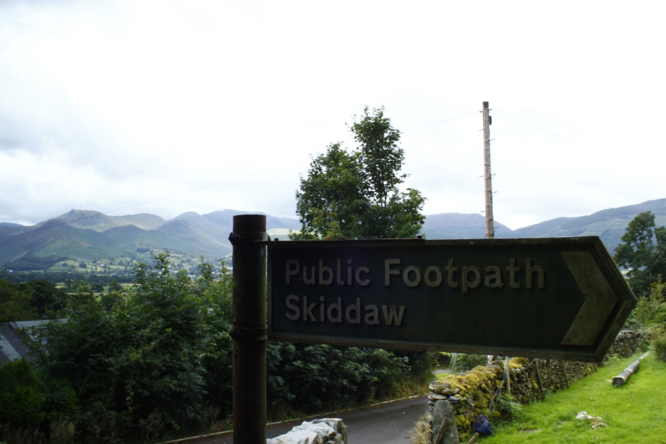
Skiddaw: Our first summit attempt.
